ISRO Satellite Imagery Confirms Weakening Deep Depression with No Fresh Storms Brewing in Surrounding Seas
 anuprova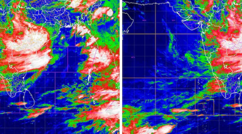
Latest infrared satellite imagery captured by the Indian Space Research Organisation’s (ISRO) INSAT-3DR satellite and analyzed by the India Meteorological Department (IMD) reveals that the Deep Depression which originated over the Bay of Bengal has moved significantly inland and is steadily weakening. Crawling west-northwest across central India at approximately 12 kilometers per hour, the storm’s core cloud mass is currently centered over the Odisha, Chhattisgarh, and Madhya Pradesh belt. Meteorological observations confirm that both the northern Bay of Bengal and the Arabian Sea have returned to a calm monsoon state, with no new cyclonic circulation or low-pressure vortex forming over open waters. Forecasters note that while the system’s slow inland movement continues to channel moisture and feed widespread rainfall across parts of central and western India, the lack of fresh marine disturbances indicates that the ongoing intense spell will gradually abate over the coming days as the depression dissipates.
About The Author